POWER DISTRIBUTION

The Distribution system is a wide network consisting of different distribution lines spread over thousands of kms over both urban and rural areas. These distribution lines pass through terrains of varying nature like hilly, plain, forest and wetlands and sometimes these lines pass through densely populated areas or forest areas.
These lines need to be inspected on a regular basis for maintaining high standards of availability and for maintaining clearances as per regulations. A minimum clearance for vegetation is required in the corridor to prevent flashover or any kind of problems. Further regular monitoring of these lines including hardware parts for overloading/
Problem:
-
At present, line survey is carried out through manual intervention like walk-over survey and through manual monitoring and these methods are only SOS based, very tedious and time-consuming.
-
Thus, routine maintenance is not proper and prone to errors.
-
Moreover, there is no practice of having predictive maintenance which is very essential for ensuring reliable and secure power supply.
-
It is imperative that technological innovations currently available must be adopted by Utilities for enhancement and to increase efficiency in the maintenance management field.
A solution we provide with uniqueness:
Solution:-
-
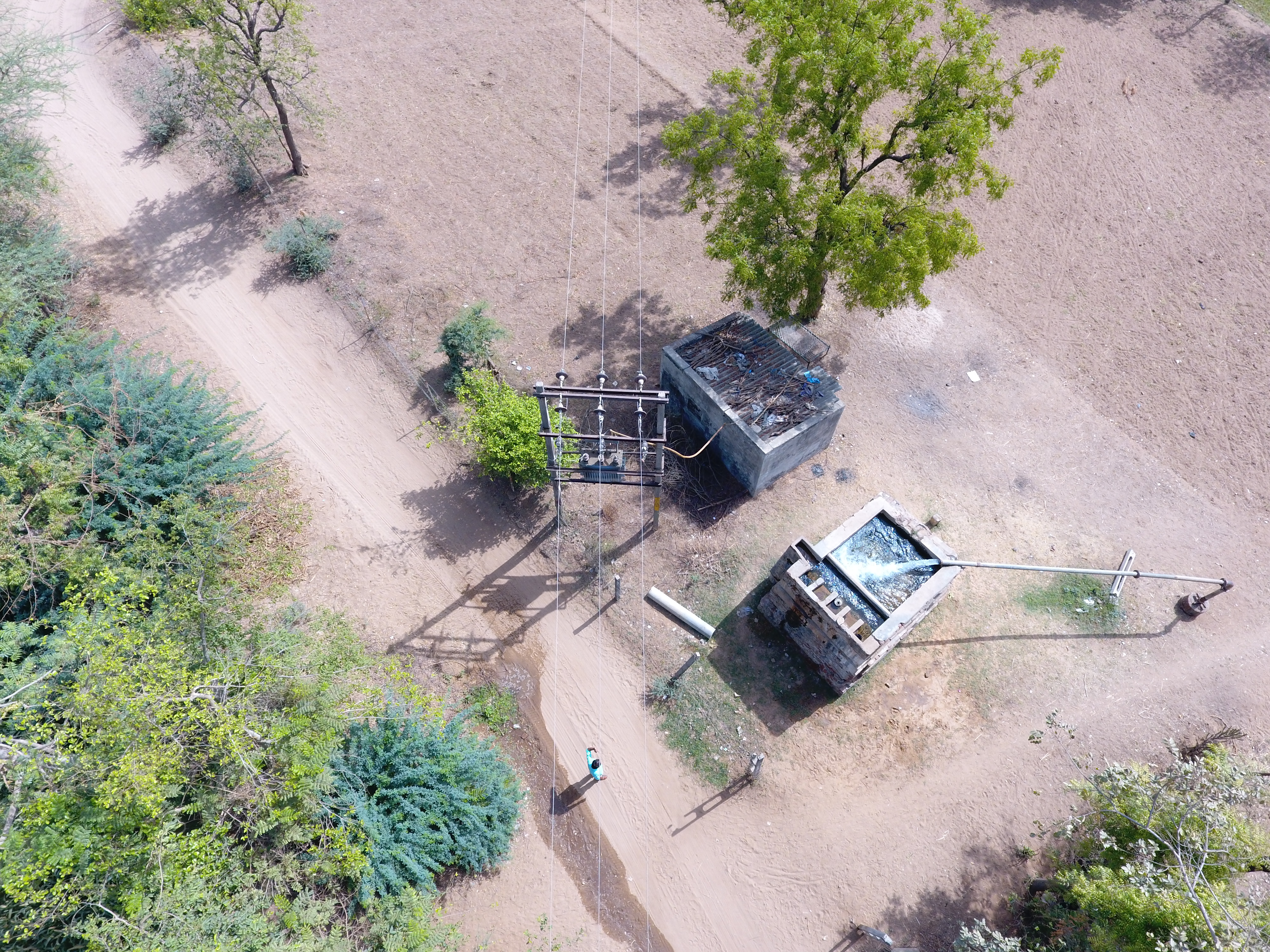
Our process starts with an airborne survey of line corridors using a Drone equipped with an HD Image scanner.
-
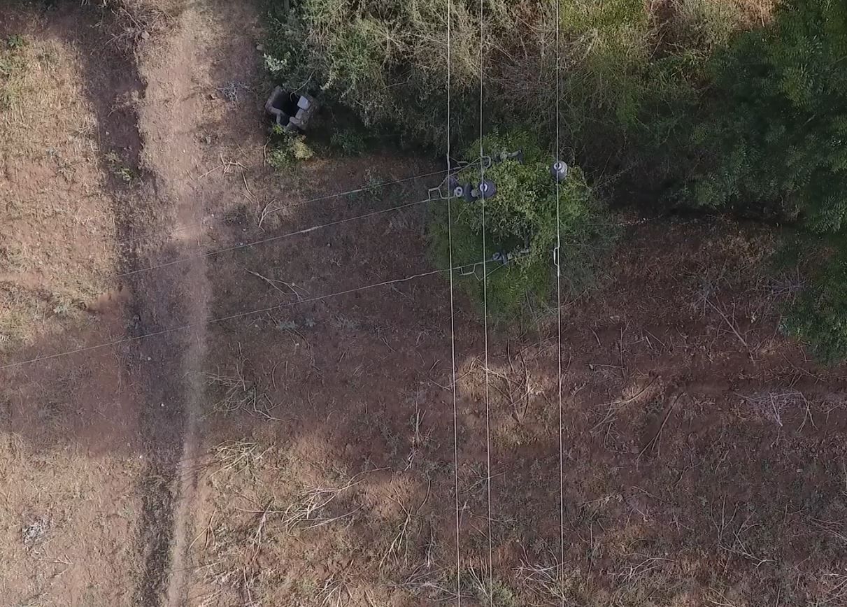
It carries outs inspection and monitors all power lines in a feeder including lines, towers, and vegetation.
-
It identifies vulnerable and critical tower/joint locations where problem spots are developing.
-
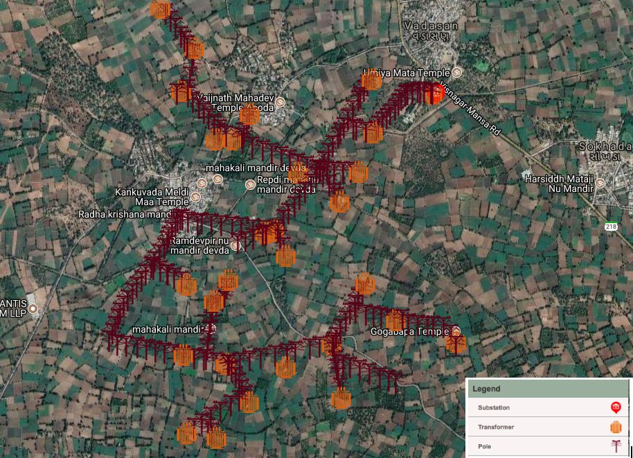
We also integrate survey and mapping of all utilities with GIS for updating each and every pole, tower, and important locations on the line network.
Our Uniqueness:-
-
Our service team efficiently captures data without switching off the network in any conditions.
-
Our team autonomously captures data using Drones with very less manual intervention.
-
Our data analyzer helps utilities to calculate the assets existing and manage them accordingly.
-
Our recommendation such as identification of risk-prone assets/network along with exact locations helps utilities reduce their action time by 95% for maintenance.
What We Deliver:-
-
Video recording of complete line and on-demand making it available for live inspection.
-
HD-Images and Video Documentation of every pole, distribution transformer and critical objects are available on the network.
-
HD-Images of the line hardware and creating an excel document showing the per pole hardware details like insulators, guy wires, y-
crossarm , jumpers. -
Checking and Inspection for Vegetation Encroachment and creepers Around Poles.
-
Checking for Irregularities in the Network, Crossings, Abnormal Pole Angles.
-
Checking for Key Regulations such as wire clearance from Ground near Roads and Highways, and line crossings.
-
Creating a map with pole attributes, Lat-Long of each pole and critical points in the network, in a .dwg file format which can be imported in GIS software.
-
Span-All Distances between poles in the entire network.
-
Mapping and Overlaying of Prepared Network Map in GIS, CAD for further use.